
Tropical Storm Dolly forms in the Atlantic Ocean
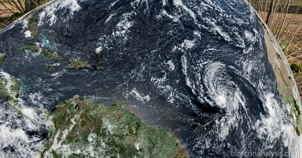
A Fourth Named Storm Emerges in a Quiet Atlantic Season
Bizeconanalysis.com – The 2026 Atlantic hurricane season, long characterized by below-average activity, produced its fourth named system on Thursday when Tropical Storm Dolly organized over open ocean waters. The development came just before 11 a.m. Eastern time, placing the new storm roughly 1,555 miles east of the Leeward Islands and well away from any populated coastline at the moment of formation. Its appearance breaks a stretch of relative calm that meteorologists had anticipated given the prevailing climate backdrop.
Storm Characteristics and Immediate Trajectory
At the time of designation, Dolly carried maximum sustained winds of 40 mph — a figure that sits just above the 39-mph threshold separating a tropical depression from a tropical storm. The system was moving rapidly westward across the central Atlantic basin, heading in the general direction of the Lesser Antilles. Forecasters at the National Hurricane Center indicated that the storm’s intensity would remain largely unchanged during the first two days following its formation, with no significant strengthening anticipated in the near term.
The longer-range outlook, however, points toward decay rather than intensification. The center’s guidance projects that Dolly will lose its organized structure before making any landfall or close passage of inhabited islands.
“Dolly is forecast to degenerate into a tropical wave before it reaches the Leeward Islands,” likely on Saturday.
Even in its weakened state, the remnant circulation is expected to shed copious moisture over the Caribbean island chain. Flash flooding remains a realistic hazard for portions of the Leeward Islands through Sunday, while the Virgin Islands, Puerto Rico, and the island of Hispaniola could experience similar rainfall-driven hazards extending into Monday. Residents in those areas should monitor local weather advisories and prepare for the possibility of localized flooding, even though a direct storm strike is not in the forecast.
Seasonal Context: El Niño’s Suppressing Influence
Dolly’s arrival as the fourth named storm of the year underscores just how muted this particular season has been. The Atlantic hurricane season spans June 1 through November 30, and in a typical year the basin produces well over a dozen named systems by mid-October. This year’s tally — Arthur, Bertha, Cristobal, and now Dolly — trails the long-term average considerably.
The shortfall aligns with predictions made at the season’s outset. A deepening El Niño event in the Pacific Ocean has strengthened upper-level wind shear across the tropical Atlantic, a condition that systematically tears apart developing tropical systems before they can organize. Warmer-than-average sea-surface temperatures in the eastern Pacific enhance the Walker Circulation, tilting the trade winds and increasing vertical wind shear over the main development region. The result is a basin that resists tropical cyclogenesis, precisely the pattern observed so far in 2026.
That said, a quiet first half of the season does not guarantee a quiet second half. Climate variability can shift, and even under El Niño conditions, isolated storms can develop, particularly if local oceanic conditions become favorable. Forecasters continue to monitor the basin through the remainder of November.
The Naming Coincidence
The timing of Dolly’s formation carried an unexpected cultural resonance. The storm organized just days after the passing of country music icon Dolly Parton, who died at age 80. The overlap is purely coincidental — Atlantic storm names are assigned on a fixed rotating schedule and are not chosen in response to contemporary events.
The World Meteorological Organization compiles lists of storm names roughly six years ahead of the season in which they will be used. Names are organized alphabetically and cycled through in strict sequence; any system that reaches tropical-storm strength receives the next available name on the list. The name “Dolly” had been slated for this position in the rotation long before the current season began, making the temporal proximity to Parton’s death an unscripted coincidence rather than a deliberate selection.
What to Watch Going Forward
For island communities in the eastern Caribbean, the practical takeaway is straightforward: expect elevated rainfall totals through the weekend and into early next week, with flash-flood risk concentrated in low-lying and poorly drained areas. No direct storm-force winds are anticipated. For the broader Atlantic basin, the question of whether additional systems will develop before the season’s close remains open, though the prevailing El Niño–driven shear environment continues to favor suppression over genesis.
Related Reading
Frequently Asked Questions
What is Tropical Storm Dolly forms in the Atlantic?
Tropical Storm Dolly forms in the Atlantic is the main topic of this guide. The article explains the context, practical details, and next steps readers should understand.
Why does Tropical Storm Dolly forms in the Atlantic matter?
Tropical Storm Dolly forms in the Atlantic matters because readers are looking for a useful answer, not just a short summary. Good content should match search intent and help them decide what to do next.